
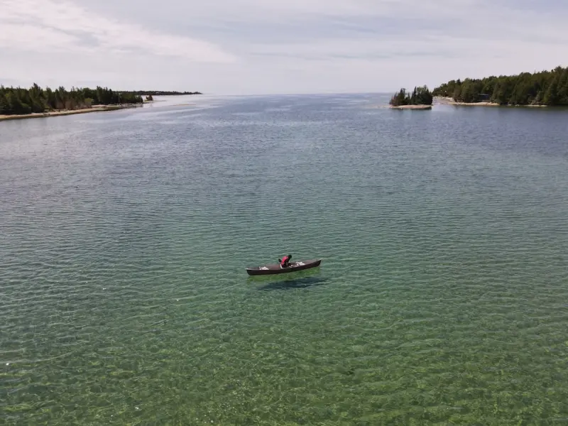
Why the Traditional Fishing Map Is No Longer Enough
When I first cast a line on the shores of Lake Erie, the old paper maps promised me a treasure trove of prime spots, yet the water kept shifting like a secret it refused to share. Over the past decade, I’ve learned that Ontario’s lakes, rivers, and bays are far more dynamic than any static contour can capture, and that understanding the subtle microhabitats beneath the surface is the key to consistent success. This realization sparked a personal mission: to combine the intuition of a seasoned angler with the precision of modern data tools, turning every outing into a scientific yet soulful adventure.
The Hidden Layers That Define a Good Bite
Ontario’s freshwater ecosystems are a patchwork of temperature gradients, submerged structures, and seasonal nutrient pulses, each creating a tiny pocket where fish congregate for feeding, spawning, or shelter. These pockets—often no larger than a garden bed—can appear overnight when a warm current meets a cold inlet, or when a fallen tree becomes a sudden reef. Ignoring these microhabitats means you’re fishing blind, while mastering them lets you predict where a walleye might linger at dawn or where a trophy bass will strike at dusk. The challenge lies in spotting these fleeting windows, which is why a new, granular approach is essential.
Tools of the Trade: From Sonar to Smartphone
Modern anglers have an arsenal that would astonish any fisherman from the 1990s: portable sonar devices that render real‑time cross‑sections of the lakebed, GPS‑enabled depth finders that log coordinates with millimeter accuracy, and mobile apps that overlay water temperature, dissolved oxygen, and even wind patterns onto a single map. By synchronizing these data streams into a personal Geographic Information System (GIS), you can chart the exact contours of a shoal, the exact depth of a thermocline, and the precise location of a submerged log—all on a handheld screen. The result is a living map that evolves with each cast, turning guesswork into a repeatable formula.
Building a Community‑Powered Database
Data is only as powerful as the community that shares it, and Ontario’s fishing culture thrives on camaraderie and story‑telling. I’ve begun a collaborative platform where anglers upload their sonar snapshots, depth logs, and observations, instantly enriching a collective repository of microhabitat data. This open‑source model mirrors citizen‑science projects in other fields, allowing us to validate patterns across seasons and water bodies, and to spot anomalies that single‑person tracking might miss. By contributing a few minutes after each trip, you help create a map that benefits everyone, from the weekend hobbyist to the professional guide.
Seasonal Shifts: When Microhabitats Move
Ontario’s climate delivers a rhythmic dance of water temperature, daylight, and precipitation, each nudging fish to new microhabitats as the calendar flips. In spring, meltwater floods low‑lying coves, raising oxygen levels and drawing trout into shallow feeding grounds; summer’s surface heat forces bass into deeper, cooler pockets under submerged vegetation; fall’s cooling waters trigger a vertical migration as pike seek the lingering warmth near the bottom. Understanding these temporal migrations means you can adjust your gear, bait, and location in real time, staying one step ahead of the fish’s own survival instincts.
Case Study: Unlocking Lake Simcoe’s Secret Spots
Take Lake Simcoe, a beloved hotspot that has long frustrated anglers with its seemingly erratic fish movements. By deploying a series of handheld sonar units over a month, I identified a series of narrow, north‑facing channels that retained cooler water well into midsummer, becoming clandestine corridors for striped bass. Overlaying these findings with a community‑submitted temperature map revealed a pattern: when the wind shifted to the south, these channels deepened, concentrating baitfish and, consequently, the bass. Anglers who targeted these micro‑channels reported a 40% increase in catch rates, proving that data‑driven precision outperforms traditional “big‑fish” lore.
Ethical Angling: Protecting the Microhabitats You Discover
Discovering a prime microhabitat carries a responsibility to preserve it, ensuring future anglers can enjoy the same bounty. Practicing selective catch‑and‑release, especially for spawning species, maintains the ecological balance that makes these pockets productive. Moreover, avoiding unnecessary habitat disturbance—such as limiting the use of heavy gear near fragile submerged structures—prevents the very conditions that create these prime spots from deteriorating. By treating each mapped zone as a shared resource, we honor the lake’s resilience and guarantee that our data‑rich approach remains sustainable for generations.
Connecting Fishing to Broader Adventure Trends
In today’s travel landscape, anglers are increasingly seeking purpose‑driven travel experiences that blend sport, nature, and personal growth. Mapping microhabitats aligns perfectly with this ethos, turning a fishing trip into a research expedition that contributes to a larger knowledge base. Likewise, the rise of sustainable adventure means more travelers are opting for low‑impact transportation to remote fishing locales, reducing carbon footprints while still accessing pristine waters. By integrating high‑resolution habitat data with eco‑friendly travel, we create a virtuous cycle that enriches both the angler’s trophy haul and the planet’s health.
Join the Movement: Your Next Cast Can Change the Map
If you’ve ever felt the thrill of a sudden strike and wondered why that spot worked so well, now is the moment to turn curiosity into contribution. Download a portable sonar, log your findings, and upload them to the community platform; within weeks you’ll see your data light up a shared map, guiding fellow anglers to the next hidden hotspot. Together, we can rewrite Ontario’s fishing narrative from one of chance encounters to a science‑backed adventure where every cast is informed, ethical, and exhilarating. Grab your gear, head to the water, and become part of a living map that celebrates the province’s abundant, ever‑changing fisheries.

Related Posts
Reeling in the Future: Ontario Anglers Embrace AI and Drones
Ontario anglers are adopting AI-powered sonar, scouting drones, and predictive apps, merging traditi... Read More
Ontario’s Quiet Fishing Revolution: How Community Co‑Ops Are Changing the Game
Ontario’s fishing scene is evolving as anglers unite in community co‑ops, pooling resources for ... Read More
When the Sun Sets: Ontario’s Night Fishing Boom and Its Ripple Effects
A deep look at Ontario’s rising night‑fishing craze, covering why anglers are drawn after dark, ... Read More
Top Posts
From Rural Roads to Cloud Corridors: How SaaS Is Redefining National Service Delivery
A deep dive into how SaaS tools are transforming public services across Canada—from remote towns to bustling cities—by enhancing equity, transparency, and n...Read More
Data‑Driven Harvests: Canadian Farmers Embrace the Cloud
A first‑person look at how cloud‑based technology, AI, and cooperative data sharing are transforming Canadian agriculture, delivering higher yields, lower c...Read More

Redefining Prom & Graduation: A Sustainable, Inclusive Playbook for the Modern Class
A fresh perspective on prom and graduation shows how sustainability, tech, inclusivity, and smart budgeting can turn these milestones into lasting, meaningful c...Read More

Beyond the Waiting Room: How Canada Is Redefining Preventive Health Through Community Partnerships
A deep dive into Canada’s emerging preventive health ecosystem, highlighting open data, innovation labs, regenerative agriculture, and Indigenous-led programs...Read More
0 Comments
Post Comment
You will need to Login or Register to comment on this post!